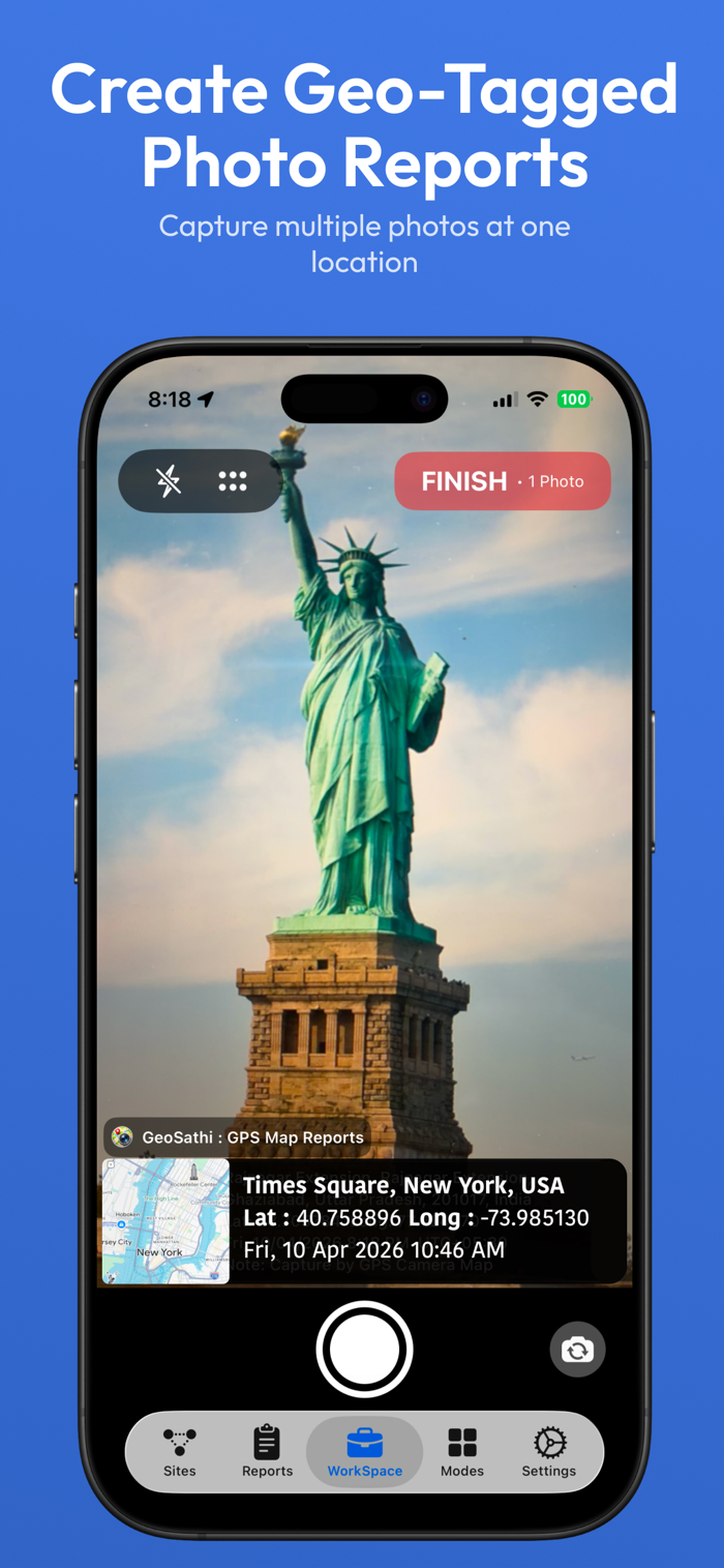
GeoSathi helps you create reports by capturing multiple geo-tagged photos in a single session, each automatically tagged with location, time, and accuracy.
Instead of saving individual geo-tagged photos, GeoSathi organizes all captures into a structured report and gives you a well understandable summary. This makes it easy to document site visits, work progress, travel, or inspections in a clear and verifiable format.
Key Features:
• Create Reports: Capture multiple photos in one session to generate a single report
• Geo-Tagged Captures: Each photo includes location, time, and accuracy data
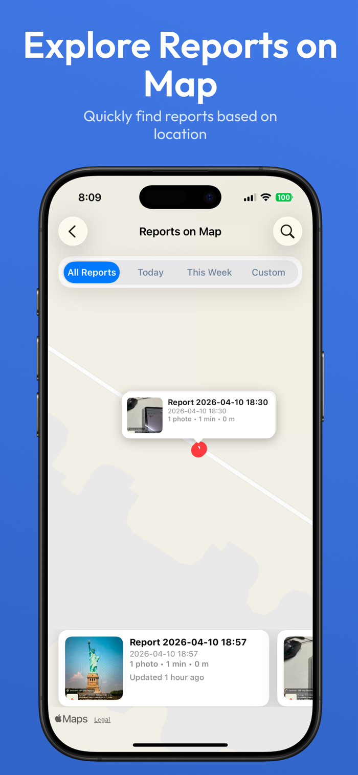
• Report Summary: View all captures with distance, duration, and map-based organization
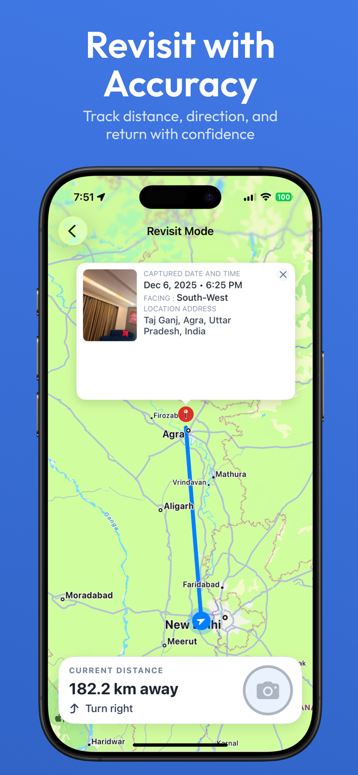
• Revisit Locations: Navigate back to exact locations where photos were taken
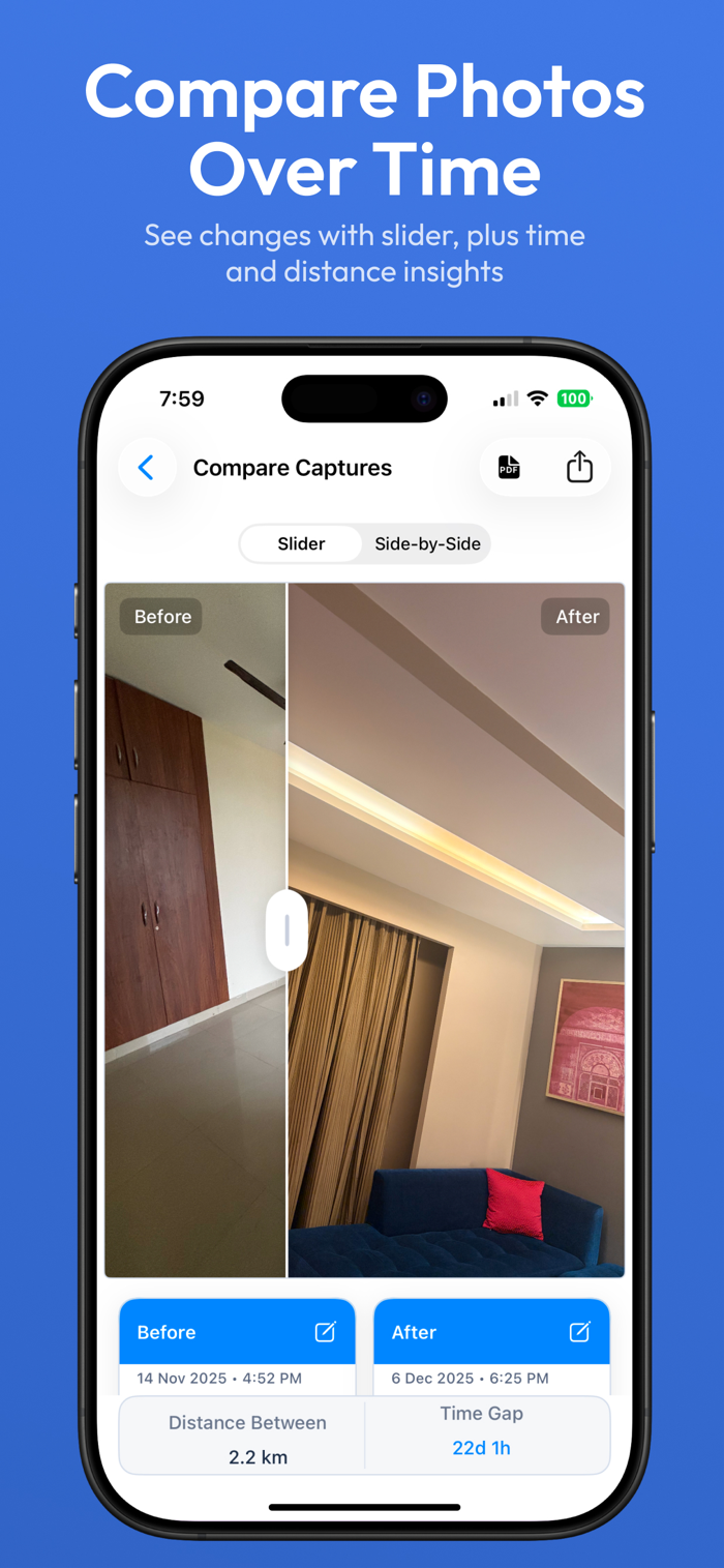
• Compare Captures: Compare two photos (from same or different reports) with time and distance differences
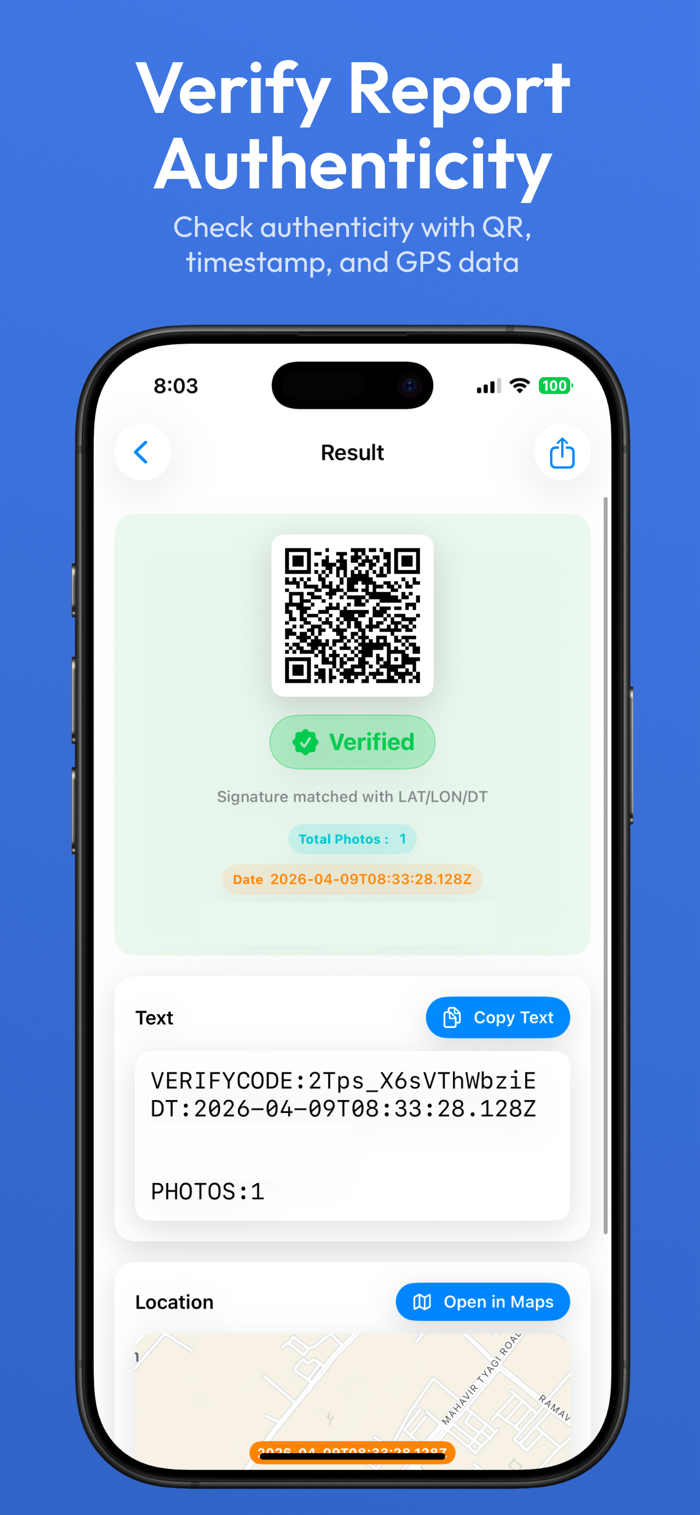
• QR Verification: All reports are imbedded with QR code for verification. User can also scan QR code for report authentication
• Multiple Languages: Designed for global usability
GeoSathi focuses on structured reporting, helping you keep location-based records organized, track changes over time, and verify your data when needed.
Download Now !!!
Auto-renewable Subscription:
• GeoSathi offers two auto-renewable subscription options:
– Weekly plan at $2.99/week with a 3-day free trial
– Yearly plan at $49.99/year
• Subscribing gives ...

 +100宝石

 分享
分享


用户评价
立即分享产品体验
你的真实体验,为其他用户提供宝贵参考
💎 分享获得宝石
【分享体验 · 获得宝石 · 增加抽奖机会】
将你的产品体验分享给更多人,获得更多宝石奖励!
💎 宝石奖励
每当有用户点击你分享的体验链接并点赞"对我有用",你将获得:
🔗 如何分享
复制下方专属链接,分享到社交媒体、群聊或好友:
💡 小贴士
分享时可以添加你的个人推荐语,让更多人了解这款产品的优点!
示例分享文案:
"推荐一款我最近体验过的应用,界面设计很精美,功能也很实用。有兴趣的朋友可以看看我的详细体验评价~"
关注 Mergeek 公众号
领奖遇到问题?联系小门助手