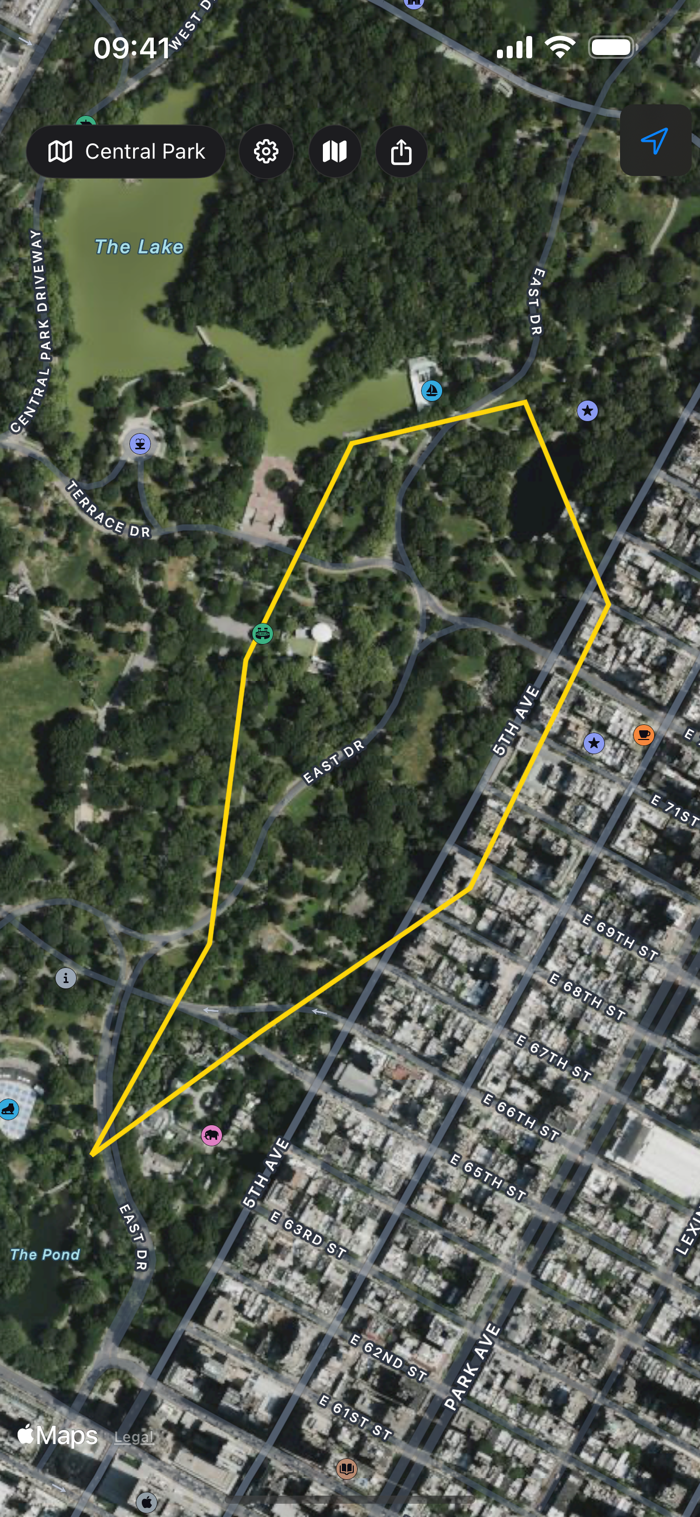
TopoWalk turns your iPhone into a GPS-guided land boundary walker. Load a trail file, walk the boundary, and watch waypoints turn green as you reach each one.
WALK ANY BOUNDARY
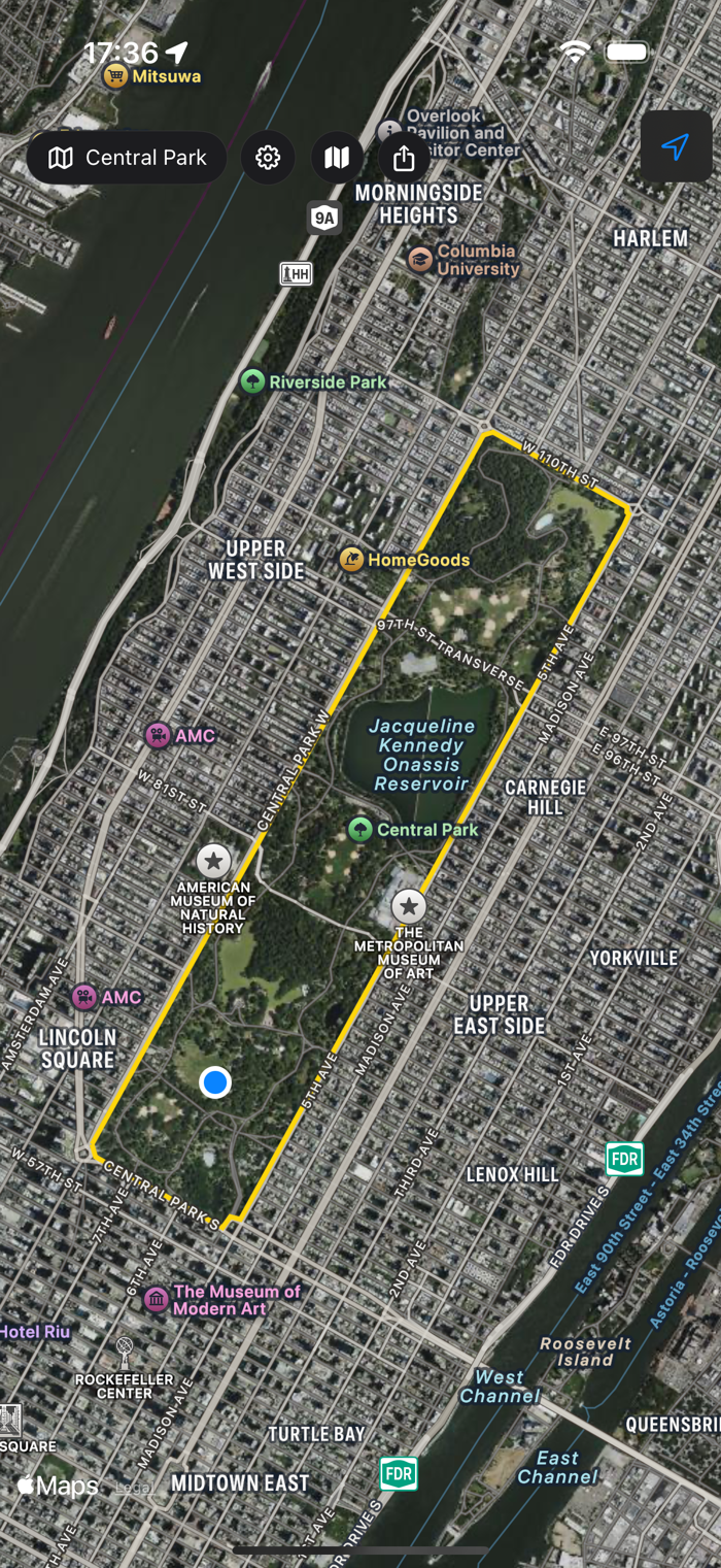
Load land parcels, property boundaries, or hiking trails from GPX, KML, DXF, and Shapefile formats. TopoWalk shows each waypoint on a satellite map with a yellow boundary line connecting them.
GPS GUIDANCE
Real-time distance to the next waypoint, off-trail warnings, and an audio chime when you arrive within 1 meter of each point. Never miss a boundary corner again.
CONVERT BETWEEN FORMATS
TopoWalk is the only app that converts between all major surveying and trail file formats. Import a KML cadastral map from a surveyor, convert it to GPX for your hiking app, export as DXF for AutoCAD, or save as Shapefile for GIS software. One tap to convert — no desktop software needed.
Supported conversions:
• GPX ↔ KML ↔ DXF ↔ Shapefile (SHP)
• Import from email, Files app, or any cloud storage
• Export and share in any format
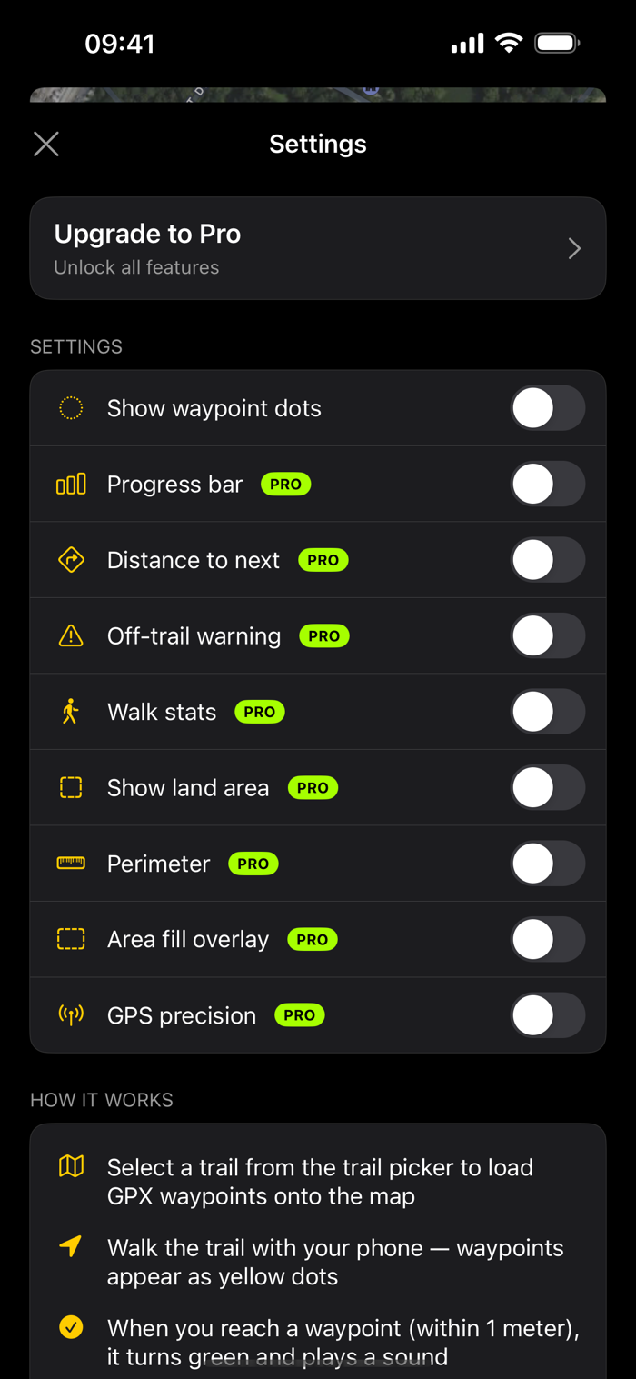
TRACK YOUR PROGRESS
See how many waypoints you've visited, total distance walked, land area and perimeter calculations — all updating live as you walk.
44 WORLD LANDMARKS INCLUDED
Explore boundaries of famous landmarks: Buckingham Palace, Taj Mahal, Vatican City, Stonehenge, Machu Picchu, Forbidden City, and many more — all with real satellite-accurate boundaries from OpenStreetMap.
FREE FEATURES
• GPX file suppor...

 +100宝石


 分享
分享


用户评价
立即分享产品体验
你的真实体验,为其他用户提供宝贵参考
💎 分享获得宝石
【分享体验 · 获得宝石 · 增加抽奖机会】
将你的产品体验分享给更多人,获得更多宝石奖励!
💎 宝石奖励
每当有用户点击你分享的体验链接并点赞"对我有用",你将获得:
🔗 如何分享
复制下方专属链接,分享到社交媒体、群聊或好友:
💡 小贴士
分享时可以添加你的个人推荐语,让更多人了解这款产品的优点!
示例分享文案:
"推荐一款我最近体验过的应用,界面设计很精美,功能也很实用。有兴趣的朋友可以看看我的详细体验评价~"
关注 Mergeek 公众号
领奖遇到问题?联系小门助手