
 +100宝石

加入 Mergeek 福利群
扫码添加小助手,精彩福利不错过!
若不方便扫码,请在 Mergeek 公众号,回复 群 即可加入
- 精品限免
- 早鸟优惠
- 众测送码
指南针-经纬度定位海拔水印相机
Geolocation Camera: Real-time tracking of location and altitude, recording safe ...
 分享
分享


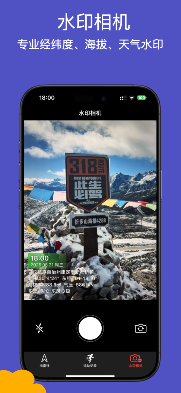


**Professional Geolocation Tools**: Real-time tracking of location, altitude, temperature, wind direction, etc., with synchronized display of weather data and recording of movement trajectories. Supports offline real-time acquisition of bearings, suitable for scenarios such as travel, mountain climbing, and navigation. The watermark camera can take photos marked with longitude and latitude, facilitating quick understanding of geographical features and environmental changes, and ensuring operational safety. Comprehensive functions, reliable services, and strict privacy protection.


用户评价
立即分享产品体验
你的真实体验,为其他用户提供宝贵参考
💎 分享获得宝石
【分享体验 · 获得宝石 · 增加抽奖机会】
将你的产品体验分享给更多人,获得更多宝石奖励!
💎 宝石奖励
每当有用户点击你分享的体验链接并点赞"对我有用",你将获得:
🔗 如何分享
复制下方专属链接,分享到社交媒体、群聊或好友:
💡 小贴士
分享时可以添加你的个人推荐语,让更多人了解这款产品的优点!
示例分享文案:
"推荐一款我最近体验过的应用,界面设计很精美,功能也很实用。有兴趣的朋友可以看看我的详细体验评价~"
领取结果