Your photos remember exactly where you stood. Ubimage puts them back there.
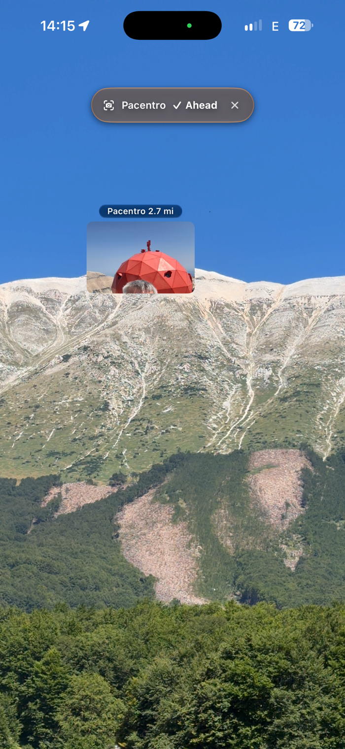
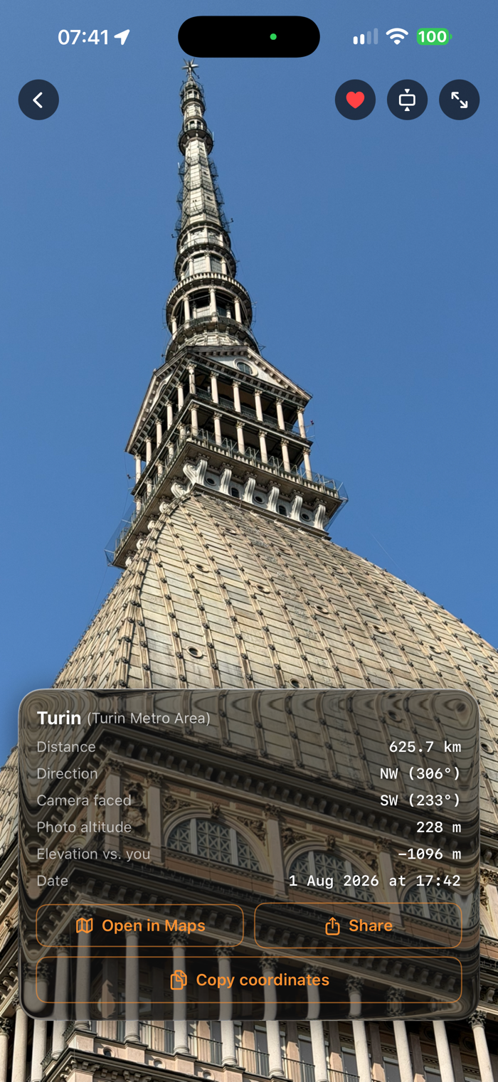
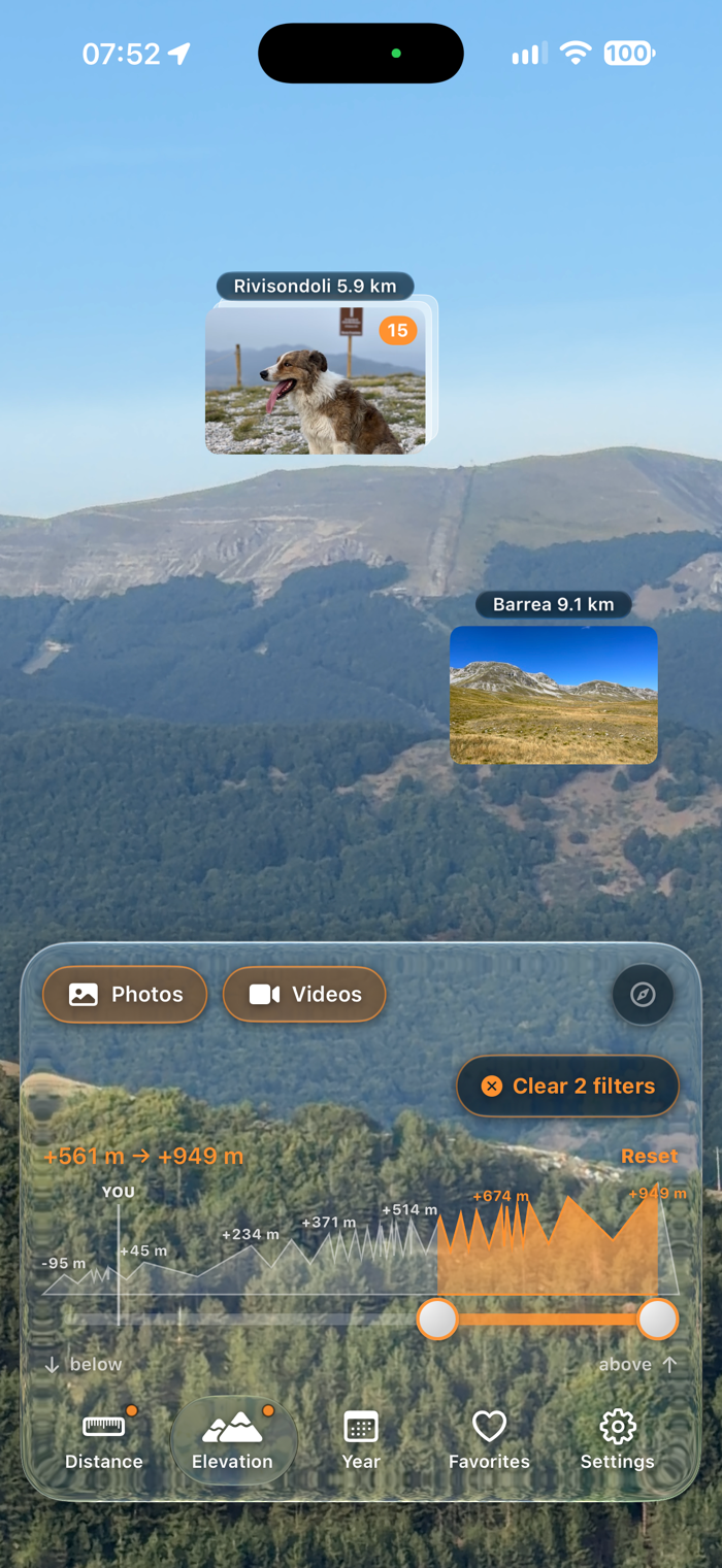
Raise your phone and look at the landscape: the photos you have already taken appear as pins on the real horizon, each one where it was shot. The peak across the valley, the street two blocks away, the coastline you walked last summer. Distance and elevation are respected, so a mountain twenty kilometers out sits high and far, and a photo taken on the corner sits close and low.
WHAT IT DOES
Live camera view
Your geo-tagged photos and videos are anchored to the real landscape using the compass, the accelerometers and the altitude of the place they were taken.
Turn around and the pins stay where the places are.
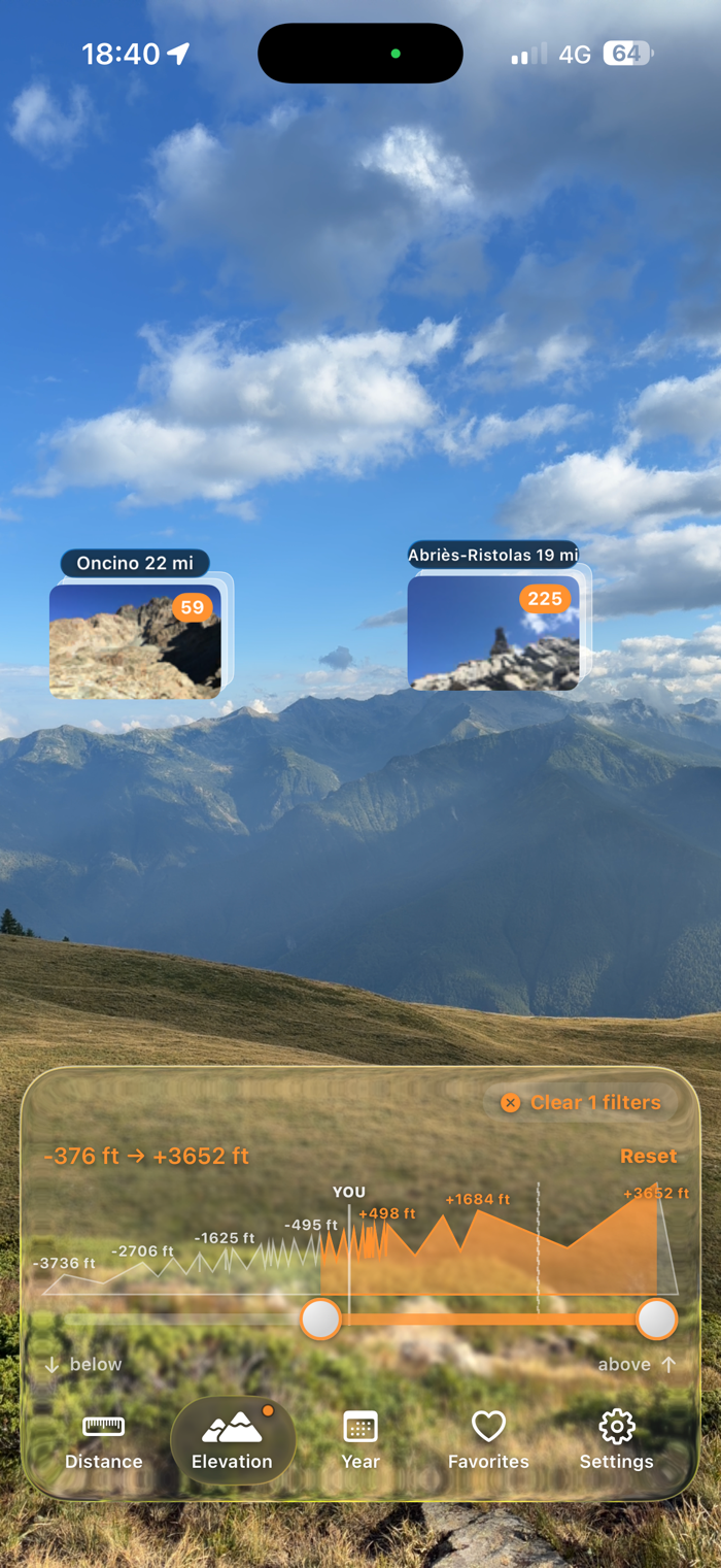
Distance and elevation filters
Keep only what is far away, and the foreground clutter disappears. Isolate the summits, and everything below goes quiet. A histogram shows where your photos actually are, with the name of the place written above each bar.
Clusters that make sense
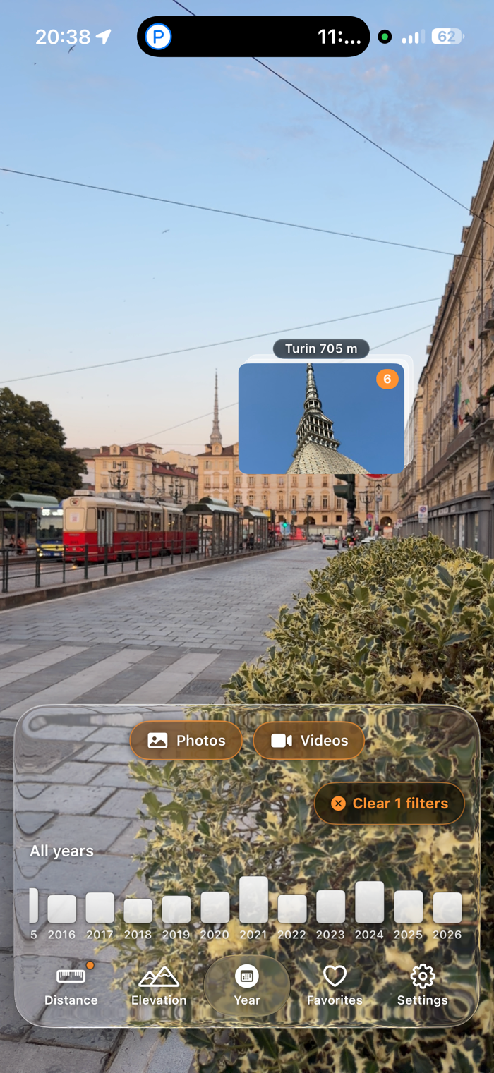
Photos and videos from the same place group into a single pin.
Photos in the same direction but at very different distances stay separate, so a town on the horizon is never mixed with a street around the corner.
Shot direction
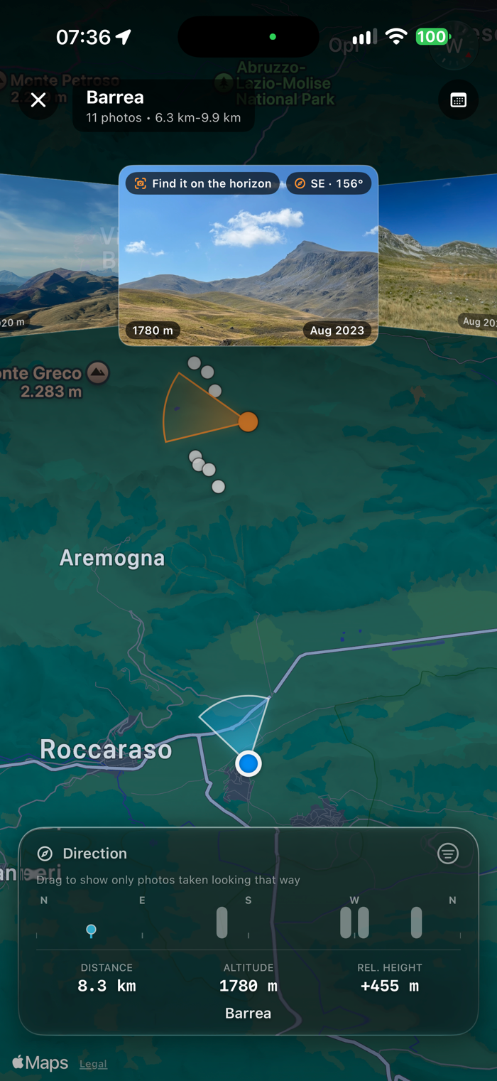
Open a photo and the map shows a cone pointing where the camera was aimed, widened to the real angle of view of that shot. Panoramas open wide, telephoto shots stay narrow. Compare it with the cone showing where you are looking n...


 +100宝石

 分享
分享















用户评价
立即分享产品体验
你的真实体验,为其他用户提供宝贵参考
💎 分享获得宝石
【分享体验 · 获得宝石 · 增加抽奖机会】
将你的产品体验分享给更多人,获得更多宝石奖励!
💎 宝石奖励
每当有用户点击你分享的体验链接并点赞"对我有用",你将获得:
🔗 如何分享
复制下方专属链接,分享到社交媒体、群聊或好友:
💡 小贴士
分享时可以添加你的个人推荐语,让更多人了解这款产品的优点!
示例分享文案:
"推荐一款我最近体验过的应用,界面设计很精美,功能也很实用。有兴趣的朋友可以看看我的详细体验评价~"
关注 Mergeek 公众号
领奖遇到问题?联系小门助手