Piri Reis Marine Navigation turns your iPhone into a chartplotter for every sea on Earth - with its richest detail in the Mediterranean.
See where your boat is on a live map, follow your heading and speed in knots, measure the distance to any point on the water, plan a route, record your track - and let the anchor watch guard your boat while you sleep.
FREE
- Live GPS position, speed in knots, heading and accuracy
- Route planning with distance in nautical miles
- Distance measurement to any point
- Favourite waypoints, stored on your device
- Navigation recording with GPX file export (Garmin, OpenCPN, Google Earth)
- Storm warnings: automatic 48-hour gale check for your favourite spots and current position
- SOS: send your exact position to your emergency contacts over WhatsApp or SMS, or share it with one tap
- Wind speed, direction and Beaufort scale
- Day and night map themes
- 13 languages spoken around the Mediterranean
PIRI REIS PREMIUM
- Anchor Watch: drop a virtual anchor, set a safe radius - if your boat drifts, a loud alarm sounds, even with the screen off
- Offline charts: download the areas you sail, or the Sea Chart Pack - all world seas with depth shading plus the entire Mediterranean in detail
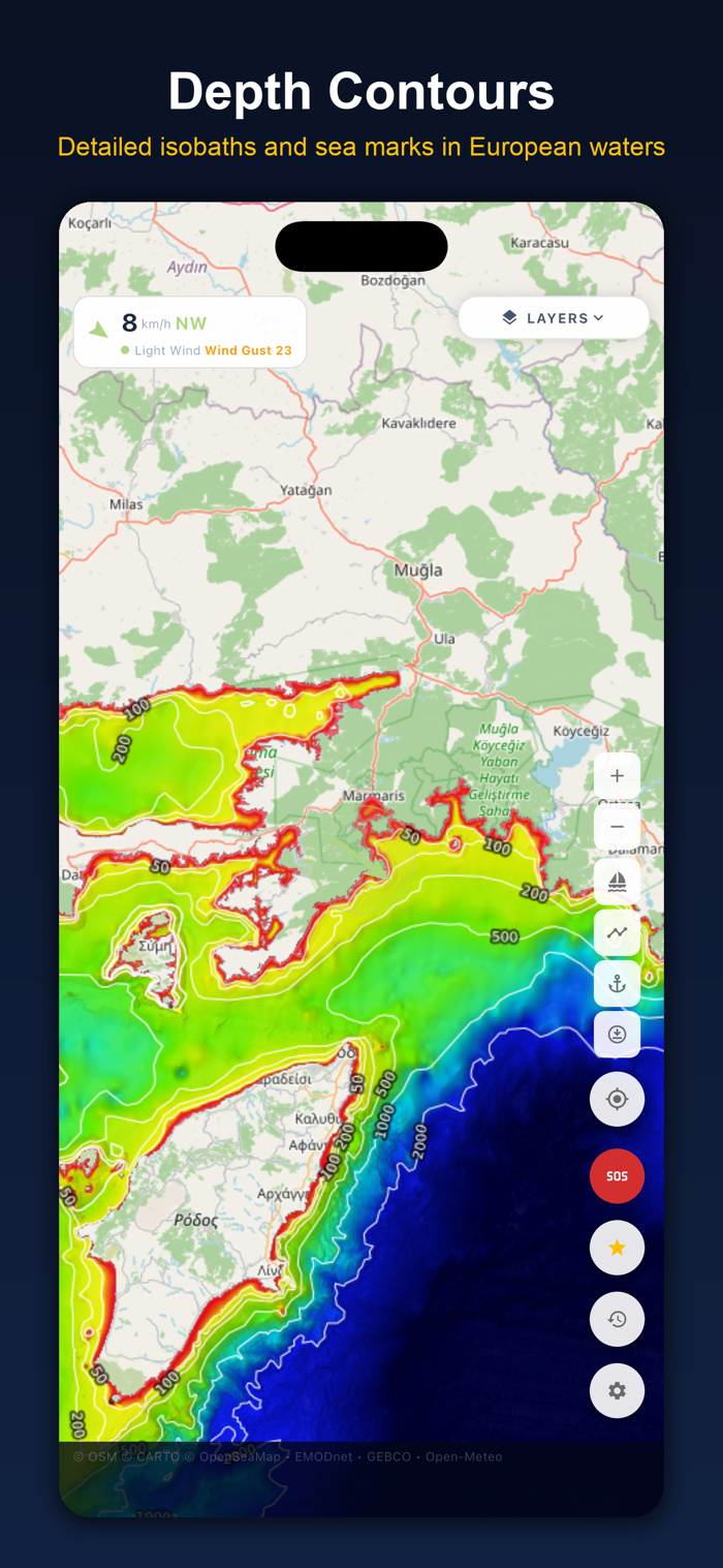
- Depth map: worldwide depth shading (GEBCO) and detailed contour lines in European waters (EMODnet)
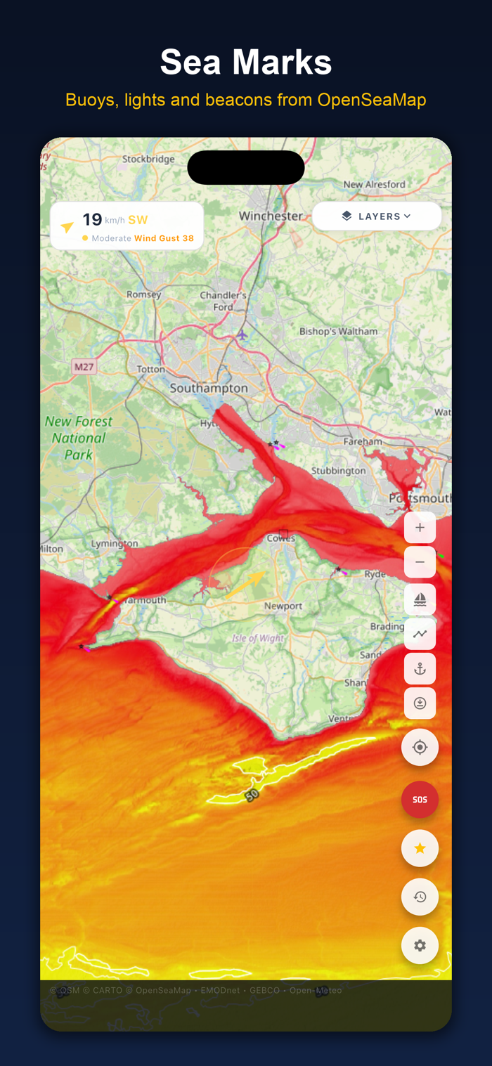
- Sea marks: buoys, lights and beacons from OpenSeaMap
- Rain radar
- Detailed ...


 +100宝石


 分享
分享












用户评价
立即分享产品体验
你的真实体验,为其他用户提供宝贵参考
💎 分享获得宝石
【分享体验 · 获得宝石 · 增加抽奖机会】
将你的产品体验分享给更多人,获得更多宝石奖励!
💎 宝石奖励
每当有用户点击你分享的体验链接并点赞"对我有用",你将获得:
🔗 如何分享
复制下方专属链接,分享到社交媒体、群聊或好友:
💡 小贴士
分享时可以添加你的个人推荐语,让更多人了解这款产品的优点!
示例分享文案:
"推荐一款我最近体验过的应用,界面设计很精美,功能也很实用。有兴趣的朋友可以看看我的详细体验评价~"
关注 Mergeek 公众号
领奖遇到问题?联系小门助手