Explore and Manage Maps with Precision with GMaps Gis Map Surveys
Experience unparalleled accuracy in land surveying and management with GMaps Gis Map Surveys! Designed for both professional surveyors and casual users, our app offers comprehensive features for high-precision mapping and geographical measurements.
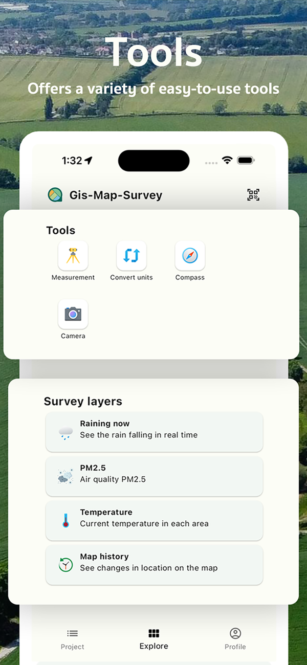
Key Features:
* Land Measurement: Utilize high-precision tools for measuring area and distance on maps.
* Coordinate Capture: Easily add various coordinates to your map and build your private coordinate database.
* Survey Data Logging: Record survey details with customizable forms.
* Collaboration: Efficiently work together with your team on surveying and land management projects.
* Unit Conversion: Quickly and accurately convert between various measurement units.
* Compass: Navigate your travels with a high-precision compass.
* GPS Map Camera: Use your device's camera for measuring coordinates and display them on a GPS map.
Ideal for Agriculturists, Surveyors, and Resource Managers:
Whether you're measuring land for agriculture, construction, or resource management, GMaps Gis Map Surveys is an essential tool for planning and managing your terrain.
Multiple Data Export Options:
Supports exporting data in formats like KML, GeoJSON, and Excel to suit all your needs.
Supports Various Coordinate Types:
Whether you need place coordinates, latitude/longitude, DMS, UTM, MGRS, or Geohash, our app has ...

 +100宝石


 分享
分享


用户评价
立即分享产品体验
你的真实体验,为其他用户提供宝贵参考
💎 分享获得宝石
【分享体验 · 获得宝石 · 增加抽奖机会】
将你的产品体验分享给更多人,获得更多宝石奖励!
💎 宝石奖励
每当有用户点击你分享的体验链接并点赞"对我有用",你将获得:
🔗 如何分享
复制下方专属链接,分享到社交媒体、群聊或好友:
💡 小贴士
分享时可以添加你的个人推荐语,让更多人了解这款产品的优点!
示例分享文案:
"推荐一款我最近体验过的应用,界面设计很精美,功能也很实用。有兴趣的朋友可以看看我的详细体验评价~"