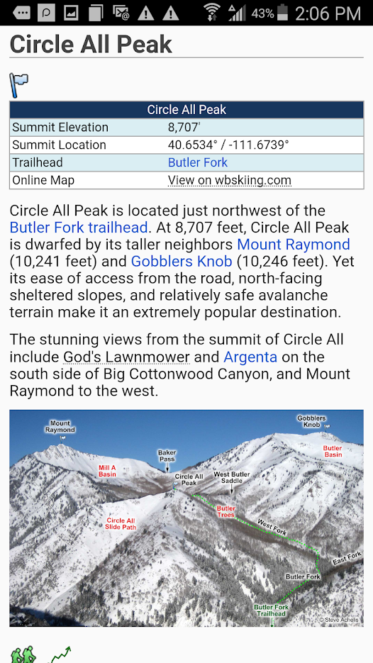
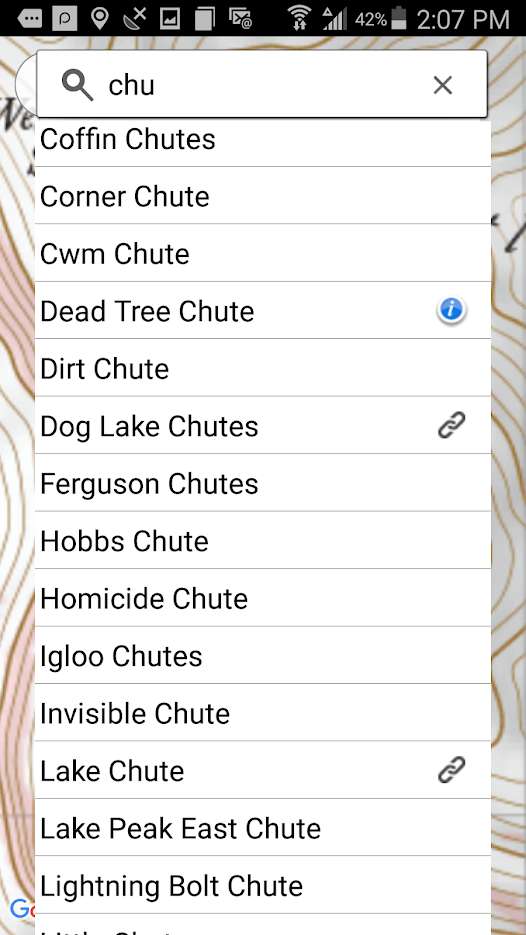
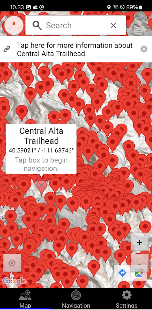
The Wasatch Backcountry Skiing Map (WBSkiing) is the Android version of the popular paper map and website (see https://WBSkiing.com). As with the other platforms, the Android map includes an index to more than 1,000 backcountry locations in Utah’s Central Wasatch mountains. It is the must-have map for Utah hikers and backcountry travelers.
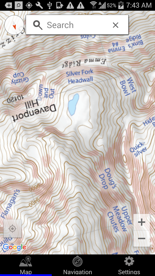
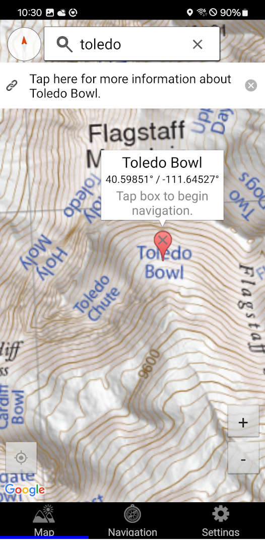
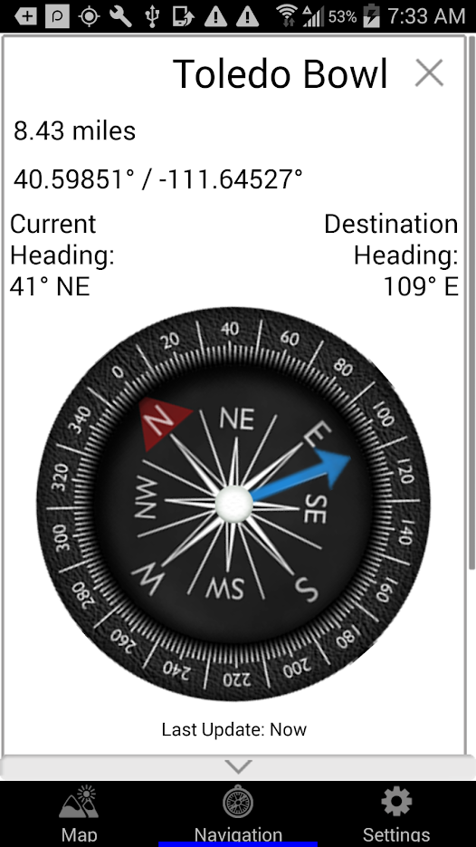
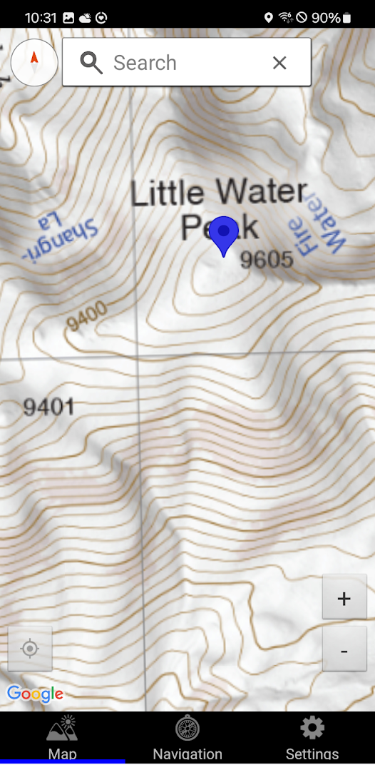
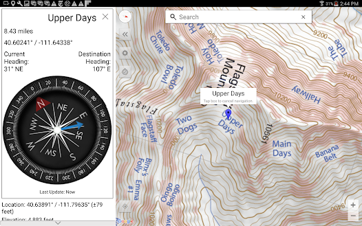
With a familiar interface, the Wasatch Backcountry Skiing Map accesses your device’s GPS to display your current location on a high-resolution topo map. And with only a few taps, the “destination arrow” on the integrated compass will point to your desired backcountry ski location. The map has "reddish" shading on slopes that are approximately 30 degrees or steeper. This shading will help you reduce your exposure when in avalanche terrain.
The app also displays your current elevation, latitude/longitude, and will send your current location via email. The app also links more than 200 of the locations to https://wbsguide.com where you can learn about the skiing difficulty, skinning distance, vertical climb, parking considerations, and more.
You do not need to have cell service to use this app--you don't even need a contract with a cell service provider.
If you encounter a problem with this app, PLEASE contact me using the support link (or via https://WBSkiing.com) before leaving a negative review.

 +100宝石

 分享
分享