Trap.nz is the collaboration tool of choice in the march toward Predator Free 2050. Used and funded by many of NZ's regional councils it provides project coordinators, volunteers, and landowners the ability to each play a core role in dramatically improving the environment we live in.
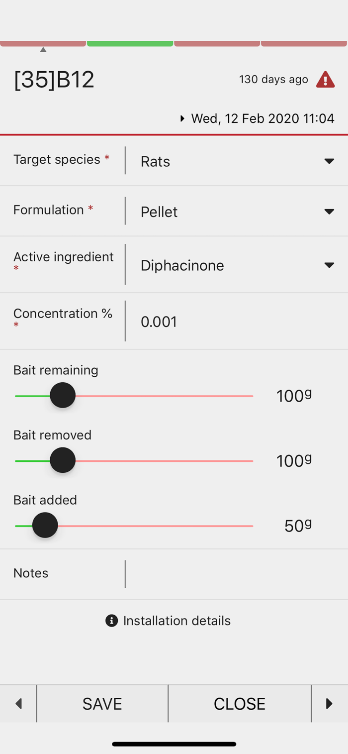
The app is your on the ground tool for mapping, locating and managing trap, monitoring site and bait station records:
- Simplified data entry (no more spreadsheets)
- Seamless on-line / off-line synchronisation (no network coverage required)
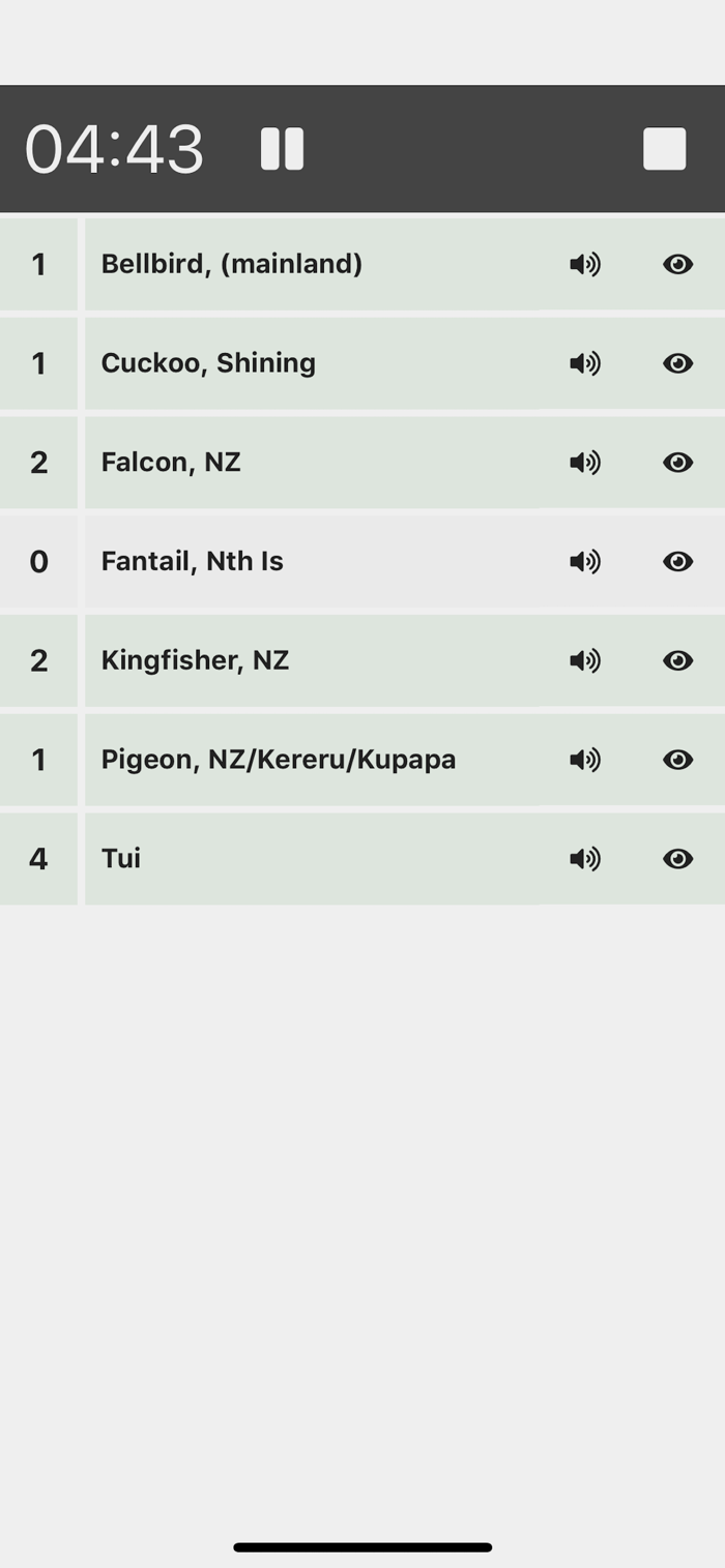
- Built in 5 minute bird count functionality
- Real time status of installations
- Scheduling and daily logs
- An array of base maps including topographic, street, aerial and parcel boundaries
- Integration with many remote monitoring tools (such as econode and celium)
To get started you will need a Trap.NZ account and a project. It's free, so sign up and join or create a project at https://trap.nz, then see our App help section - https://trap.nz/help/app.
Trap.nz takes away the need for in-house GIS skills and for larger projects removes the many hours of managing spreadsheets. Providing evidence and accountability for funding becomes trivial.
With a Trap.nz project you get:
- User management (control access levels, assign traps etc)
- Access to powerful reporting including Heat Maps (all at the click of a button)
- Printable maps (great for non-techy t...


 +100宝石

 分享
分享


用户评价
立即分享产品体验
你的真实体验,为其他用户提供宝贵参考
💎 分享获得宝石
【分享体验 · 获得宝石 · 增加抽奖机会】
将你的产品体验分享给更多人,获得更多宝石奖励!
💎 宝石奖励
每当有用户点击你分享的体验链接并点赞"对我有用",你将获得:
🔗 如何分享
复制下方专属链接,分享到社交媒体、群聊或好友:
💡 小贴士
分享时可以添加你的个人推荐语,让更多人了解这款产品的优点!
示例分享文案:
"推荐一款我最近体验过的应用,界面设计很精美,功能也很实用。有兴趣的朋友可以看看我的详细体验评价~"
关注 Mergeek 公众号
领奖遇到问题?联系小门助手